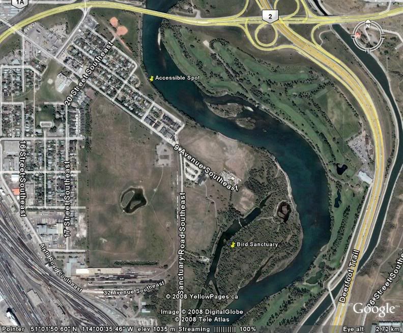
The waterways within the sanctuary (off the main river system) are off limits. You can see the side channels in the Google Earth image. If you use Google maps you can zoom in as well.
http://maps.google.ca/maps?hl=en&tab=wl
I marked one spot I know that is close that is accessible easily. There are many other spots south from this location, but this is the closest I know of to the sanctuary.