Go Back   Alberta Outdoorsmen Forum > Main Category > Fishing Discussion

Reply
 
Thread Tools Display Modes
  #1  
Old 07-28-2008, 11:17 AM
camshaft camshaft is offline
 
Join Date: May 2007
Location: Calgary
Posts: 689
Default Anyone floating the red deer from dickson?

Looking for info on this stretch of the red deer. I have a inflatable 12.5 footer that I would like to launch at the damn and float downstream. Problem is I dont know where to leave a 2nd vehicle and pull out.

Anyone have any advise on where a person would float to (not looking to float to innisfail), but at least a 3-8 hour float would be good.

How is the water clarity and flow this time of year, have things cleared up at all? And how is the river for obstructions and obstacles to avoid?

Any help would be appreciated. Thx
Reply With Quote
  #2  
Old 07-28-2008, 12:26 PM
Chironomid
 
Posts: n/a
Default

Haven't done much fishing/floating upstream of the city, but the river is certainly back to fishable conditions, we are catching fish. Pretty well all private land between the dam and Red Deer, so unless you want to do some door knocking your only two options are the Innisfail or Penhold bridge.
Reply With Quote
  #3  
Old 07-28-2008, 12:32 PM
bobalong bobalong is offline
Banned
 
Join Date: May 2007
Posts: 4,130
Default Red deer

Quote:
Originally Posted by camshaft View Post
Looking for info on this stretch of the red deer. I have a inflatable 12.5 footer that I would like to launch at the damn and float downstream. Problem is I dont know where to leave a 2nd vehicle and pull out.

Anyone have any advise on where a person would float to (not looking to float to innisfail), but at least a 3-8 hour float would be good.

How is the water clarity and flow this time of year, have things cleared up at all? And how is the river for obstructions and obstacles to avoid?

Any help would be appreciated. Thx

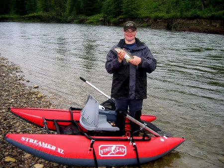
I don't have any current info, but we did float it a few years back before the flood. I believe the water is a little higher and more stained than usual right now. We used to take out on RR 205, but I know the flood did take some of this road out, and Im not sure if this still a good take out or not. The only obstructions we saw then were the odd log jam or overhanging branches, but you could see them long before you got to them. There were some very nice runs on this stretch of river, we did not catch any Browns but lots of Rockies.
Only managed to find 1 pic from back then
Reply With Quote
  #4  
Old 07-29-2008, 12:32 PM
camshaft camshaft is offline
 
Join Date: May 2007
Location: Calgary
Posts: 689
Default float

Thx.

Any idea how far floating to the hwy 54 bridge would take? I assume the river is still pretty dirty coming out of Glennifer, but how is it downstream?
Reply With Quote
  #5  
Old 07-29-2008, 02:09 PM
bobalong bobalong is offline
Banned
 
Join Date: May 2007
Posts: 4,130
Default Red deer

My cousins canoed it a couple of years ago. With no stopping I think it was about 3.5-4hours. Water clarity I am not sure of, I think I saw a post on here a couple of weeks ago though that said it was starting to clear up fairly well.
Reply With Quote
  #6  
Old 07-29-2008, 06:08 PM
jrs
 
Posts: n/a
Default

Clarity downstream of the dam is great. There's a lot of scum which gets annoying but the clarity is great for fishing, even dry fly fishing.
Reply With Quote
  #7  
Old 07-29-2008, 11:25 PM
Chironomid
 
Posts: n/a
Default

Quote:
Originally Posted by jrs View Post
Clarity downstream of the dam is great. There's a lot of scum which gets annoying but the clarity is great for fishing, even dry fly fishing.
Yup, he's speaking from experience.
Reply With Quote
  #8  
Old 07-29-2008, 11:29 PM
BEL BEL is offline
 
Join Date: May 2007
Location: Sylvan Lake
Posts: 1,328
Default Clear today

I passed over the river in Red Deer and was really surprised to see how clear it was. There is a gravel road travelling south of highway 54 between Innisfail and the dam which would serve as a takeout or starting point. It could be 205 as one person mentioned previously. It is a few miles west of Sec Hiway 78. Another spot is directly south of 781, but it is a very steep bank down to the river. BEL
Reply With Quote
Reply

Thread Tools
Display Modes

Posting Rules
You may not post new threads
You may not post replies
You may not post attachments
You may not edit your posts

BB code is On
Smilies are On
[IMG] code is On
HTML code is Off

Forum Jump


All times are GMT -6. The time now is 09:21 PM.


Powered by vBulletin® Version 3.8.5
Copyright ©2000 - 2024, Jelsoft Enterprises Ltd.